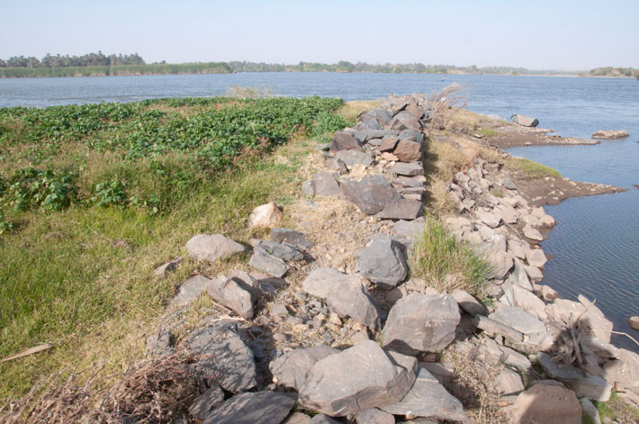
 MANCHESTER, ENGLAND—According to a statement released by the University of Manchester, an international team of scientists employed satellite imagery, drone and ground surveys, and study of historical sources, including travelers’ diaries, maps, and early twentieth-century aerial photographs, to examine some 1,300 river groins, or stone walls constructed along the Nile River between the first cararact in southern Egypt and the fourth cataract in Sudan. Many of these structures are now submerged in the Aswan High Dam reservoir, or were built along Nile channels that are now dry. Dating of the walls indicates that some of them were built more than 3,000 years ago. Some of the larger ones measure more than 16 feet wide and 650 feet long, and would have directed the flow of water within the river and assisted with the navigation of rapids, facilitating travel between Egypt and Nubia. The study also indicates that the groins trapped silts during the annual inundation of the Nile, thus supporting agriculture without the need for further irrigation. “This incredibly long-lived hydraulic technology played a crucial role in enabling communities to grow food and thrive in the challenging landscapes of Nubia for over 3,000 years,” said Matthew Dalton of The University of Western Australia. Farmers in Sudanese Nubia continued to build river groins as recently as the 1970s, and still cultivate land formed by ancient walls, he concluded. Read the original scholarly article about this research in Geoarchaeology. To read about a device that Egyptians used to gauge and help predict the Nile's annual flooding, go to "The Ancient Promise of Water: The Limits of the Nile."
Ancient Hydraulic Engineering Along the Nile River Examined
