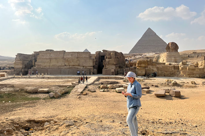
WILMINGTON, NORTH CAROLINA—According to a Cosmos Magazine report, geomorphologist Eman Ghoneim of the University of Carolina Wilmington and her colleagues have found evidence of a 40-mile-long branch of the Nile River that flowed some 4,700 years ago along the western banks of the modern Nile. The evidence was collected through the analysis of soil cores, ground-penetrating radar and tomography surveys conducted by the Egyptian National Institute, and the study of historic maps. The suggested path of the so-called Ahramat Branch is believed to have flowed by the pyramids at Abusir, Saqqara, Dahshur, Lisht, and Giza. These monuments are now surrounded by the Western Desert, but in antiquity, they were probably accessed by water and surrounded by fertile land. “There’s a common acceptance that the pyramids must have been near a waterway because they’ve got these [boat] docks, but for the first time we’ve created a map and checked on the ground that this was actually the case,” explained geomorphologist Tim Ralph of Macquarie University. Knowledge of the path of the Ahramat Branch could help researchers find lost temples and monuments through study of ancient descriptions of their locations along the river, he added. “If the river has moved… archaeologists who are looking for these places may be looking in a different place. It might help people find other sites,” Ralph concluded. To read about a defunct arm of the Nile along which workers might have transported blocks to build the Great Pyramid, go to "Around the World: Egypt."
Project Maps Possible Path of Lost Nile River Branch